Weather: Mauritius, Reunion and Rodrigues Under the Threat of the Next Storm Imelda
A tropical storm, which should be called Imelda, rode around and, according to several forecasting models, could develop into intense cyclone and a threat both to Mauritius, Reunion and Rodrigues. The West-South-West trajectory of this storm system already cause for concern.
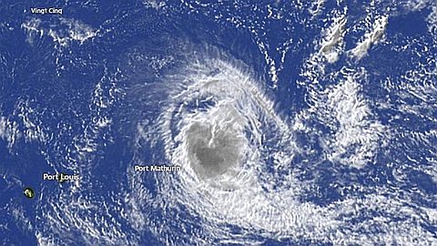
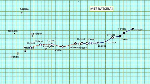
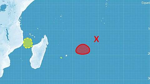
According to the Meteorological Centre of the Meeting (CMRS), the storm still in tropical disturbance was at 16 h 00 yesterday afternoon the point 10.7 ° South, 71.9 ° East, or approximately 1800 km North-East of Mauritius. It was moving at a speed of 17 km / h. But by next Thursday, it should have reached the stage of intense cyclone. Then it should be within a radius of less than 800 kilometers north of Mauritius.
Rapid intensification from Tuesday
According to an analysis of the meteorological situation in the region bulletin issued by the center Reunion, all numerical models are in good agreement on the path that would take the storm, although the timing varies somewhat. RSMC foresees the system could move west-southwest until Wednesday on the subtropical high pressure present in low altitudes troposphere. On this path, it should not increase significantly during the next 36 hours due to a persistent easterly shear generated by tropospheric ridge centered along latitude 17 ° South. The shear is expected to drop sharply from tomorrow evening or Tuesday. Future storm Imelda should quickly increase thereafter through good environmental conditions (low shear South Southeast favorable and establish good drainage canal).
Again according to the RSMC "Due to late (Wednesday and Thursday) the system could then substantially intensify and then bending southward approaching a Thalweg (corridor between two anticyclones) to middle troposphere arriving from the west and in transit South. "
In less technical terms, according to all forecasting models, including serious Mtotec site and the Joint Typhoon Warning Center (JTWC), unless a desirable Imelda weakening by Thursday, prospects Regarding a significant deterioration of the time in our region are bleak. And a Forewarned worth two, it would be better now that the population of the islands concerned are prepared. Each of the four islands in the region seems to be also exposed to potential danger.
A potentially catastrophic scenario
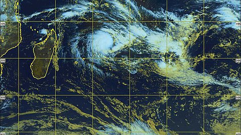
Imelda tropical storm formed Wednesday in the South-East of Diego Garcia, or in an area that experienced meteorologists call in their jargon "stable cyclones usually the most dangerous of the Indian Ocean ". First identified as a disturbed area, it initially took an east-south-east, which seemed to lead to the Australian region. It bent then to take the lead in the Western Indian Ocean. At yesterday afternoon, it adopted a trend toward West-Southwest.
According to projections meteorologists Reunion, there are strong possibilities that arrive almost at the North of Mauritius to Tuesday, Imelda again changed course to head south. This would take it to go between Tromelin and St Brandon. Such a scenario would save Madagascar (already battered by cyclones that have struck earlier this year), but would be potentially catastrophic for Mauritius, Reunion and Rodrigues, especially if, as expected, by Thursday, Imelda reached actually the maximum stage of development, that of intense tropical cyclone with sustained winds between 166 and 212 kilometers of his eye.
Beware of the hurricane!
Also in the disturbing possibility of a shift to the south, some meteorologists express concern that, by rushing into the hallway (the Thalweg) between two anticyclones move far south of Mauritius, Imelda passes between Rodrigues and Mauritius perhaps closer to the small island. It should be noted that, with regard to the areas under the threat of a cyclone, the Regional Centre for the meeting always takes care to warn that "wrap around trajectories predicted (area probability) represents the uncertainty Forecasting for any term up to five days. " "We also called the envelope cone of uncertainty. This envelope (see the trajectory traced by the center) indicates that the trajectory will follow the system over the next five days a 75% chance of being within the field of probability. "
Therefore, according to the CMRS, we must know that "the fact of being outside of the cone of uncertainty does not mean that there is no risk of being affected by the system low pressure, and the more so that it applies only to the cone center of the phenomenon and does not take into consideration the area, more or less extended around the center, winds or rains potentially dangerous. "
Meteorologists today retirement and have seen so much during their careers put them on guard against hurricanes that happen in April and, in their experience, are generally much closer to the hurricane (hurricane) mere gales.
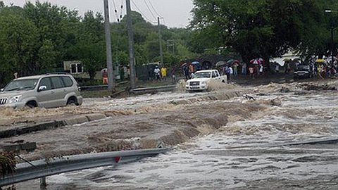
crossed fingers that Mother Nature saves us from another disaster after torrential rains deadliest weekend!