Cyclone alert Class 2: no school this Tuesday
Cyclone alert Class 2
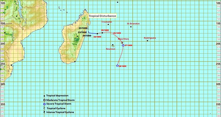
Latest satellite imagery shows that the tropical disturbance intensified into a tropical depression overnight. At 04:00, the tropical depression was centred about 630 km west-northwest of Mauritius, at latitude 18.3 degrees south and longitude 51.8 degrees east. It continues to move slowly eastwards.
According to available numerical model data, environmental conditions remain favourable for the system to intensify further. The tropical depression is also expected to eventually curve southwards.
On this forecast track, the tropical depression will approach Mauritius while gradually intensifying into a moderate tropical storm, thus representing a potential threat to the island.
The next bulletin will be issued around 10:10 a.m.