Weather: heavy Swells Continue at Monday
12 years, 11 months ago - July 15, 2013
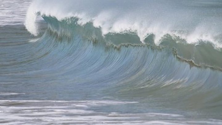
The weather service issued a warning of waves of three meters beyond the reefs in some areas in Sunday reports. On Monday, the sea is not about to rest and strong waves are expected in the South and East.
This situation is caused by the relatively strong anticyclone écolue south Mascarene. It begins to move away to the east, but a relatively cold air flow associated with the anticyclone persise our region.
On Monday, we will have to wait a half overcast and sometimes cloudy, with showers located on the top in the afternoon. The showers will be more frequent in the East and South.
The sea will remain strong beyond the reefs with waves up to three meters. The outputs on the high seas and in the lagoons of the South and East are thus discouraged.
The sea state will gradually become less bad from this afternoon as a forecaster of the weather station of Vacoas.